Hello, fellow history and mystery enthusiasts! Your favourite blogger is back (!), and today we’re diving deep (forgive the pun)into the UK’s ancient past to explore a truly remarkable, and utterly enchanting, geological phenomenon – the ice age secrets of the Pingos.
These bodies of water are the collapsed ghostly remains of colossal ice-cored hills, a chilling, yet beautiful, legacy of the last Ice Age, over 10,000 years ago. And in this post I will tell you what you will see and how to get there by walking in the footsteps of our ancient ancestors.

What is a Pingo? (And Why Do They Sound So Funny?)
The name itself, “pingo,” is borrowed from the Inuvialuit (an Inuit people) word for a conical hill. Imagine a giant, subterranean blister of ice. That’s essentially what a pingo is.
And the name of these mysterious ponds always reminds me of the 1980’s character Pingu, the funny little, clumsy penguin who lived on the polar ice caps of Antarctica having fun with his sister Pinga and his best friend Robby the seal – but I digress ………………
So at the end of the last Ice Age, the UK was a cold, periglacial landscape—not quite under the ice sheet, but still permafrost. Underground water would be forced up by pressure and freeze into a massive, expanding ice lens.
This expanding ice pushed the ground above it upwards, creating a large, dome-shaped hill (a pingo). As the hill grew, the surrounding soil would slide down to create a raised rim, or rampart.
When the climate finally warmed, the enormous ice core melted. Without its icy support, the hill collapsed, leaving behind a circular or oval-shaped depression that filled with water.
The result? The distinctive, mysterious pingo pond we see today—a true fossil of the frozen earth.

The Pingo Heartland: Norfolk and Suffolk’s Icy Legacy
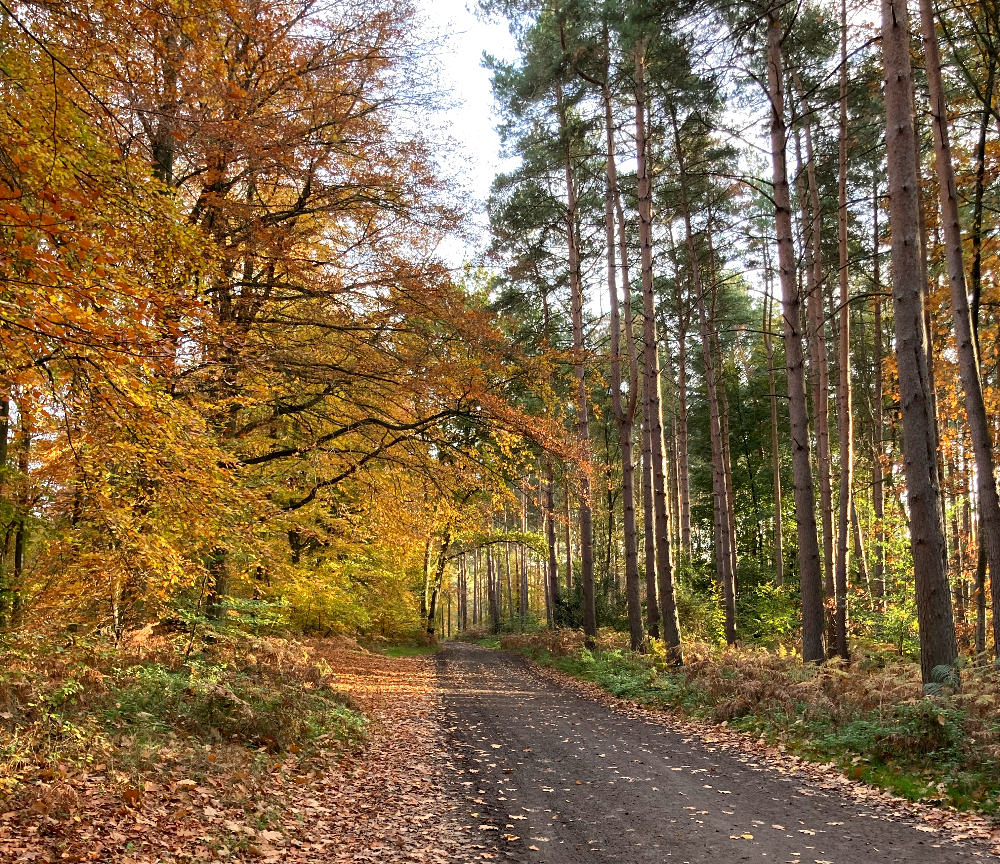
When you think of pingos in the UK, one place springs to mind – The Brecks area, straddling the border of Norfolk and Suffolk. This is the undisputed pingo capital of Britain. And I just recently walked a beautiful autumn walk along a wonderful, well trodden, easy circular trail; with a convenient car park that wasn’t too muddy. At one stage this walk took me onto the Pedders Way and it was a delight to think of all the thousand walkers before me who tread this ancient path.
- Thompson Common, Norfolk is perhaps the most famous site, boasting a stunning concentration of around 400 pingo ponds, and you are walking the route going – “there’s one, there’s one, look there’s another!” The sheer number of these features made the land practically unfarmable, which is why they have survived here in such incredible numbers maybe.


- You can for yourself walk the Great Eastern Pingo Trail and literally step back 10,000 years. Just here is a useful map for you, and as a point of interest there is a Bronze age burial ground site (a tumulus) just to your left over the fence (where you can not legally access) on MOD land, belonging to the Stanford training area – but you know it’s there, and that’s what makes this such a special, atmospheric, place; a place which has had human connections for thousands of years- exploring a landscape pocked with these ancient, water-filled craters, really is stepping back thousands of years.

But here’s where the mystery deepens… many pingos are now “ghost pingos.” Over centuries, the low-lying hollows were seen as obstacles to farming. They were ploughed, drained, and filled in, leaving only subtle, darker patches of soil or a greener, wetter patch of grass to betray their presence. Conservationists are now doing amazing work to excavate and resurrect these lost Ice Age pools. It’s a haunting reminder of the landscape that was. Luckily, dedicated conservationists are now working to excavate and resurrect these lost Ice Age pools, bringing life back to ancient, forgotten spaces.
The Wider UK Story – Beyond the Brecks
So, is the story confined to East Anglia? Not quite – While Norfolk and Suffolk are famous for their abundance of visible pingo ponds, evidence of their existence pops up in other, surprising places, confirming that this icy landscape once stretched much further.
While The Brecks is the pingo Mecca, the icy conditions that created them were widespread. So, did they leave their mark across the whole UK? The answer is a resounding YES, and in some genuinely surprising places.
- Under our bustling capital of London – Geological surveys for major projects like the Blackwall Tunnels in East London, and other sites like Battersea and Canning Town, have revealed deep, disturbed basins filled with sediment and chalk blocks. Scientists interpret these as the collapsed forms of ancient, underground pingos, presenting a genuine challenge to the engineers in times past.
- Ramparted depressions in Wales – similar in appearance to pingos, are also found across parts of central and west Wales. While their origins are debated—some geologists suggest an alternative glacial process—they are evidence of a severe, permafrost-dominated past and share the same mysterious, doughnut-like shape.
The pingos that do survive are not just geological marvels; they are ecological treasures. Their isolated, shallow, and fluctuating water levels provide a unique habitat for rare species, including Ice Age survivors like water beetles and the reintroduced Northern Pool Frog to the Thompson Common area.
Thompson Common and Great Eastern Pingo Trail and What to See
On this walk and at this reserve (managed by Norfolk Wildlife Trust) you will pass by woodland, meadows and lots of water; this year 2025 has been very dry and all the pingo’s were dry, but that hasn’t taken away any of the mystery and sheer wonder of the place. The marshy wetland and woodland is just so charming and captivating (especially with the amazing colours of the trees this autumn) you’ll keep noticing more and more beauty as you walk.

You’ll notice it is called Thompson Water, Carr and Common – the Carr bit being – ‘a low, marshy, flooded area or scrub’ dominated by willow and alder. But there are many deciduous trees here and a mix of hawthorn, rose and bramble perfect for wildlife.
Dragonflies and damselflies are said to be drawn to this area with its unique habitat and ecosystem variety. A spectacle of dragonflies dancing on the breeze can be seen here in July and early August. And if you’re interested in getting up early to hear the magnificent dawn chorus – birds such as the warbler can be heard filling the dawn air with their sound, especially in early May.
The old roman part of the road known as the Pedders Way (some suggest it is actually an ancient track, more an extension of the Icknield Way, (a trackway which was travelled in pre-historic times) which was used and remodelled by the Romans, and across Thompson Common pass some incredibly glorious swamps. Long-horn cattle graze here and there is an abundance of lichen and moss as well as fungi and pretty water violets. Spot the majestic swans using the water and above in the skies, hunting hobbies and march harriers.
How to Get There ~ Thompson Common Pingo Trail ~ A Truly, Incredible, Unique Place ~
Nearest Postcode – NR17 1DP
Location – Off the A1075 Watton-Thetford road, about 3 miles south of Watton, near Stow Bedon.
Parking is Free: at the Great Eastern Pingo Trail car park. Look for a large lay-by on the A1075 – the car park is a track that runs back from the centre of this lay-by.
Opening Times: Dawn till dusk, all year round.
Trail Length: The Pingo Trail Circular Walk is about 7-8 miles (12.9 km). If taking the kids/family, keeping their attention with a game of ‘spot the pingo’ would not be hard if you just were able to do a quarter of the walk with them,
Trail Difficulty: Easy and flat. No toilets.
Key Features: The site is famous for its pingos (around 400 post-glacial ponds), which are a unique habitat for wildlife. The walk takes you through woodland, heathland, and along a section of a disused railway line.
Dog Policy: Dogs are permitted on leads on the Pingo Trail (the old railway line and Peddar’s Way sections), but not inside the Thompson Common Nature Reserve area itself.
Top Tip: If going in the spring and early summer months it would be a good idea to take some sort of insect repellent as mosquitoes love water and also favour dawn and dusk.
Artists, storytellers and sculptures have designed a project creating works of art along the pedders way here along the old road you can see one of these 5 markers. Remember the Pedders Way is 46 miles or 74 km long and takes you through some lovely countryside.

Have you ever walked the Pingo Trail or spotted a “ghost pingo” on a winter’s day? Share your thoughts and photos below.
Until next time dear friends x